Where the River Resists: Reimagining LA
By Lucia Cappella

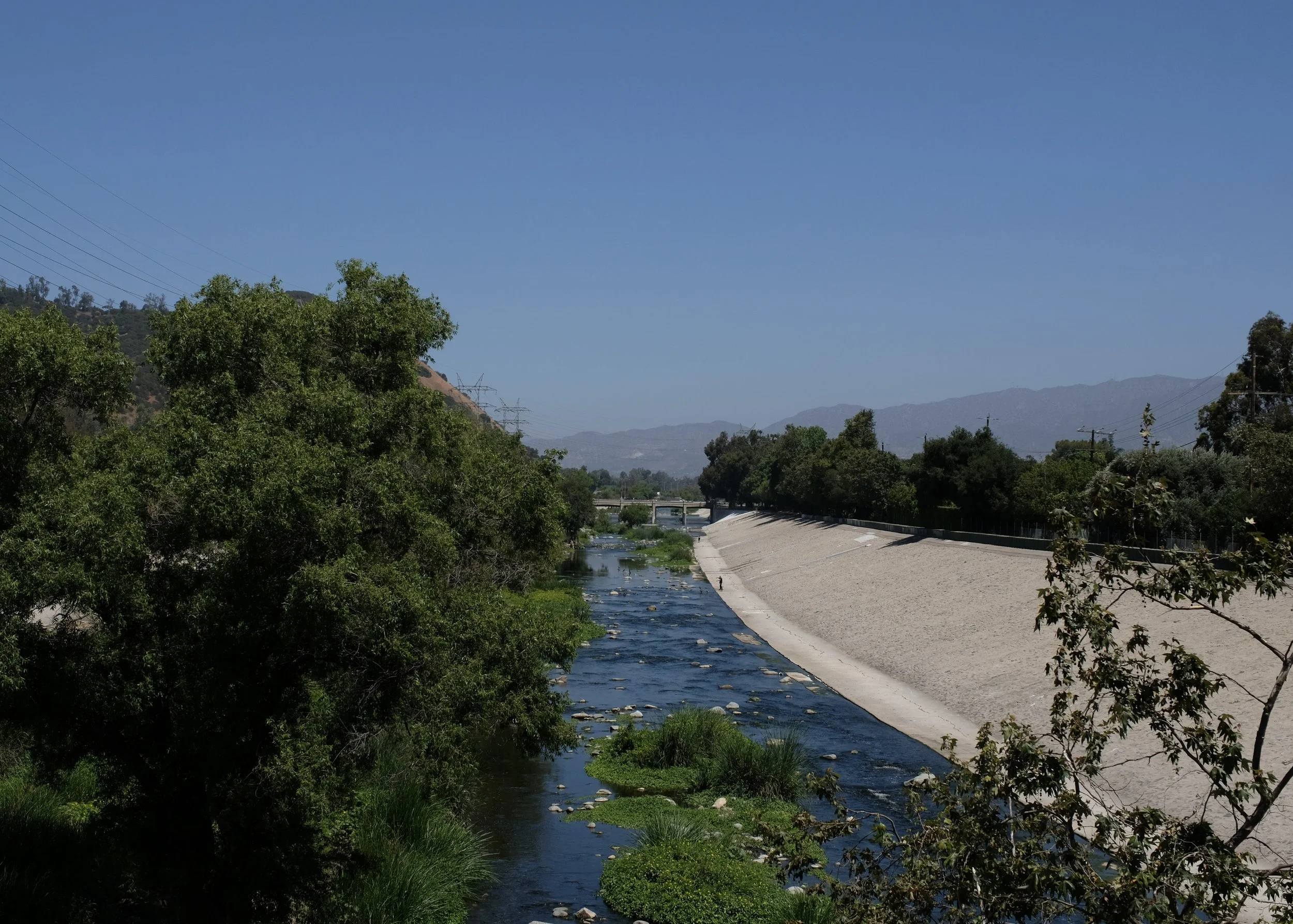
The Glendale Narrows. Photo by Talia Goddard.
A snowy egret stands poised, watching the shallow water. A cool breeze rustles the trees — willows, cottonwoods, and sycamores sprouting up from the middle of the riverbed. Close your eyes, and for a moment, you can forget you’re in the middle of one of the largest, busiest cities in the U.S.
But the moment soon fractures. The hum of the I-5 creeps in, and your eyes drift to the tangle of power lines slicing across the blue sky. It gets harder to ignore the dissonance of the scene — the river is confined by long, sloped walls, like a concrete straitjacket.
This is the Glendale Narrows, a 7-mile stretch of the LA River that runs through Northeast Los Angeles. Unlike much of the channelized river, it is a lush home to native trees, plants, and wildlife. It’s not pristine nature — the river water is heavily polluted, and the concrete banks are often lined with trash and graffiti. Still, the Narrows draws hundreds of families each day to walk, cycle, and play near its greenery.
On the afternoon of June 20th, the Glendale Narrows was also the setting of the third Festival Trail workshop. Attendees of the workshop gathered along the river’s edge as guide Jason Wise explained the ecology and history of this unique space.
The Glendale Narrows. Photo by Talia Goddard.
One of the first things Jason shared: the Glendale Narrows, as they exist today, were made by accident. The region has long been a site of contention – one where forces of nature, infrastructure, and urban growth intersect and vie for control. For centuries, the region was a vital resource for the Tongva people, who established village sites along its banks. The rich soil of the river basin drew settlers, but as the city of Los Angeles began to grow, the river came to be seen less as a lifeline and more as a threat.
A series of damaging floods prompted the city to consider ways to control the LA River. In 1930, a report called “Parks, Playgrounds, and Beaches for the Los Angeles Region” was submitted to the Los Angeles Chamber of Commerce by landscape architect firms Olmsted Brothers and Harland Bartholomew & Associates. The plan imagined 200,000 acres of green spaces running the length of the river and serving as a natural floodplain. However, after another catastrophic flood in 1934, the task was passed to the U.S. Army Corps of Engineers, who proposed a very different plan: encase the river entirely in concrete.
In 1938, crews got to work — ripping trees from the riverbank, excavating the sandy riverbed, and pouring 3.5 million barrels of concrete. By the time the project was completed two decades later, all 51 miles of the LA River, from Canoga Park through the San Fernando Valley, ran through a concrete channel.
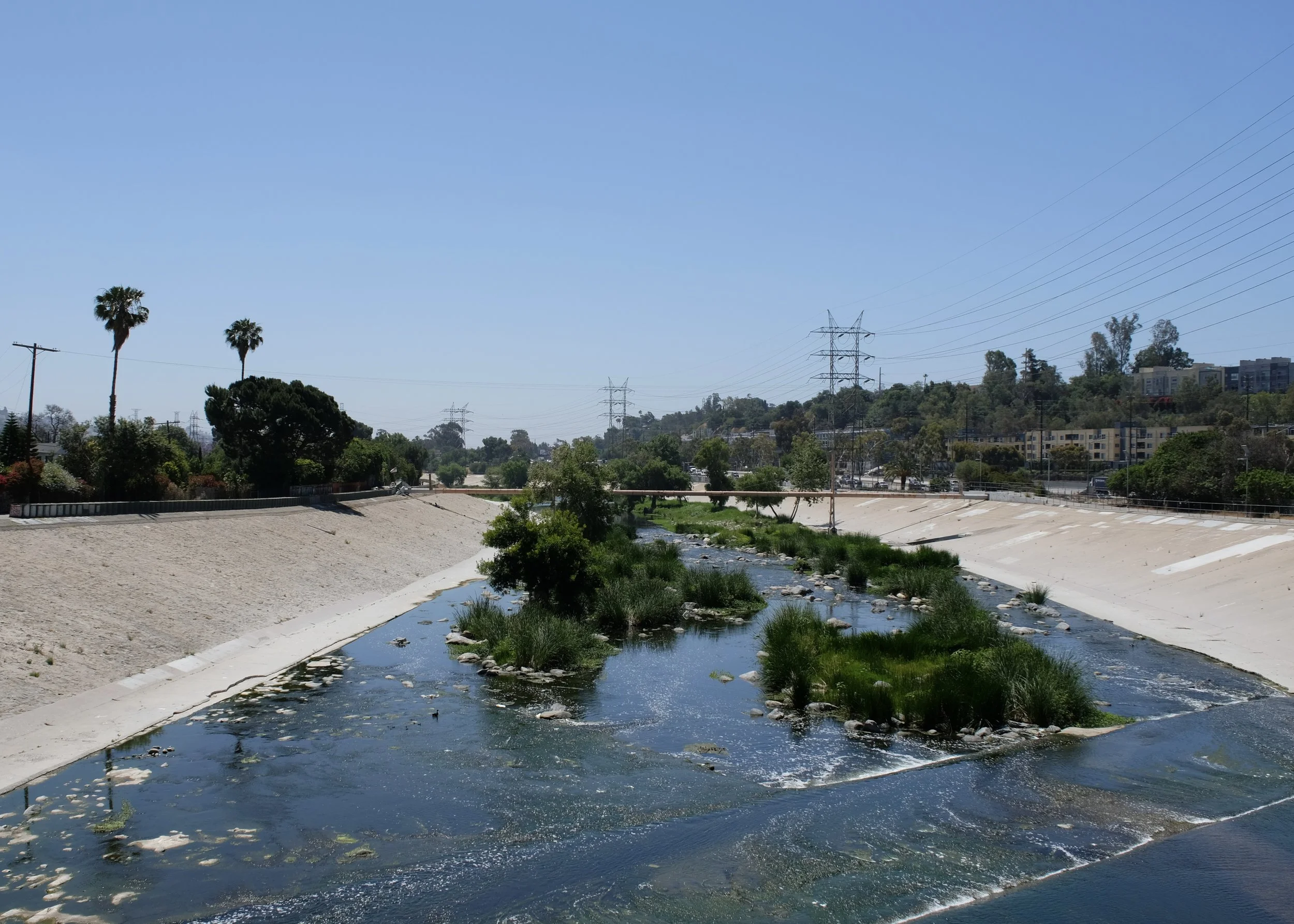
The Glendale Narrows. Photo by Talia Goddard.
Yet in the Glendale Narrows, the river resisted. This stretch of river flows across an unusually high-water table, meaning the water pressure from below made it impossible for concrete to set. As a result, this section was left with a natural soft bottom, and native plants and trees were able to reclaim the space. Today, this stretch is one of the only parts of the LA River with a natural soft-bottom — a rare glimpse of what the river once was.
The story of the Glendale Narrows, while unexpectedly hopeful, is a reminder of what might have been. It invites us to imagine what Los Angeles could look like if more of the soft-bottomed river remained — if we had implemented the Olmsted plan and had parks along the riverbanks where children could play, and communities could gather.
With that lingering sense of what if on our minds, we turned our attention to the Festival Trail — the reason we had assembled by the river that day. It was the day of the third Festival Trail workshop, and after Jason’s tour concluded, we walked a short distance to a community room overlooking the river. The space, stewarded by workshop co-host Frogtown Arts, was decorated by local artists showcasing their place-based work. Around a large table, community members, designers, mobility advocates, local leaders, and artists came together to reflect, discuss, and imagine the possibilities of how the Festival Trail could shape Los Angeles.

Workshop attendees listen to Jason Wise guide a LA River urban ecology walk. Photo by Talia Goddard.
One of the key topics was the identification of gaps: places where a lack of infrastructure, safety features, or transit options inhibits Angelenos from moving easily throughout the city. From our site of the workshop gathering, we watched cyclists and walkers enjoying the LA River Bike Path – a reminder of the city’s potential and unfinished work.
The river-hugging bike path is one of the most beloved routes in the city. From the Elysian Valley, cyclists can head upriver to the trails and attractions in Griffith Park, or downstream to the cafés and shops at Atwater Village. But try to keep going south and things get tricky. The protected bike path ends before downtown and doesn’t start up again until 8 miles south, in the City of Maywood. In that gap, the only option for cyclists is to brave the unprotected surface streets. And in a city where a pedestrian is killed every two days — a fatality rate four times higher than the national average — few are willing to risk it.
There’s enormous interest in filling this gap, and there has been for a long time. In 2010, LA Metro conducted a feasibility study that determined an in-channel bike path to be a viable project to connect the LA River bike path. It would only be inaccessible to cyclists a few days a year, when the river basin would need to be used for flood control purposes. $365 million of funding from Measure M was earmarked for the project, but more than a decade later, construction has yet to begin. Using the deadline of the 2028 Games as momentum, the Festival Trail aims to bring attention to this long-overdue project to finally connect the path.
The possibilities of a completed LA River bike path are innumerable. The route would be 51-miles long, allowing riders and commuters to safely traverse the entire stretch from the San Fernando Valley all the way to Long Beach. South LA residents could safely ride to the Glendale Narrows. Families from the Southeast could spend a car-free weekend afternoon at Griffith Park. And during the 2028 Games, visitors could hop on a bike in DTLA and follow the river upstream, stopping at the Atwater Village farmers market, and even taking the A-Line up to the Rose Bowl.
The LA River Bike Path is just one connection of many. The Festival Trail envisions an extensive network that connects the major venues of the Olympics and Paralympics, links communities to transit, and helps stitch together the sprawl of Los Angeles. Initial estimates begin to tell the story of its potential impact: the trail would create safe walking and biking access for 1.8 million Angelenos that living with a half mile of the route — including 1.3 million residents of color and nearly 287,000 people living below the poverty line. The Trail would also run along 344 schools and 25 universities, linking 673,000 students to 167 parks and green spaces. And with each new connection, the city opens in ways we can’t fully predict, creating new pathways to learning, ecological awareness, and cultural exchange. For both Angelenos and international visitors, the Festival Trail offers a way to explore — and experience — what Los Angeles has to offer.
At the LA River workshop, excitement was in the air. Attendees were eager to share ideas for everything from wayfinding markers and arts and cultural programming that could activate the trail, to creative methods for managing trash. In addition to feedback, attendees pitched ideas for how they see themselves contributing to the project. The Festival Trail vision is ambitious, and its success relies on partnerships with organizations that bring diverse expertise and use site-specific, community-driven planning methods.
One of these partners is ShadeLA, a campaign that launched in July 2025 with a mission to help prepare LA for rising temperatures by increasing access to and quality of shade. ShadeLA is helping Festival Trail create a plan for shade along the route using a combination of manmade structures and tree planting. This hybrid approach is strategic — while trees offer long-term ecological benefits, manmade shade structures are critical for achieving the level of shade needed for life-saving relief in the near term. It’s a model that reflects the story of Glendale Narrows, a space shaped by both natural resilience and human intervention.
Another partner, Los Angeles Neighborhood Initiative (LANI), brings project management and community engagement expertise in building green, safe, and accessible neighborhoods. At the LA River workshop, LANI’s Director of Development and Marketing, Franci Levine-Grater, shared how the organization engages communities from start to finish — implementing legacy projects that reflect and celebrate the identities of different LA neighborhoods. With LANI as a partner, the Festival Trail will bring green spaces to life along the route — in the spirit of the park network imagined for Los Angeles a century ago.
We can’t go back in time and choose the Olmsted Plan. We can’t undo decades of development that prioritized cars over people. But we can work with what we have. We can revitalize the city with nature — through tree canopy and pocket parks that create spaces for connection – and use smart, manmade infrastructure to address extreme heat, safety issues, and mobility barriers. And we can strategically link it all together to sow the seeds for a greener, more accessible, and more connected Los Angeles.

Chalk on the LA River Bike Path points to the site of the Festival Trail workshop. Photo by Talia Goddard.